Bangsamoro Autonomous Region in Muslim Mindanao / Cotabato City / Cotabato City
Rio Grande de Mindanao riverfront
Best for
- River corridor
- Cotabato City
Map address
Why it matters
The Rio Grande riverfront in Cotabato is part of the Mindanao River Basin. Flood storage, river branches, the Illana Bay outflow, water hyacinth, and city drainage all shape the daily risk from the river.
Place guide
Visiting the Rio Grande Riverfront
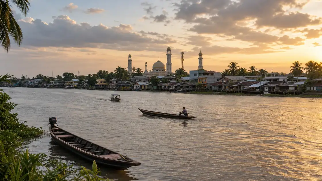
The Rio Grande de Mindanao is part of the Mindanao River Basin, the largest river system in Mindanao and the second largest in the Philippines. The river's lower stretch passes through Cotabato City before splitting into the Tamontaka River and the Rio Grande proper, both of which exit into Illana Bay. The riverfront in Cotabato City offers the most accessible view of this river for visitors.
Getting to the Riverfront
The riverfront is accessible from the city center. Tricycles and motorized transport are the primary options from Cotabato's transport terminals. The area near the riverside barangays gives views of the wide river channel, river traffic, and the flat lowland geography of the Cotabato Basin that makes this river system so significant for agriculture.
What to Expect
The Rio Grande riverfront in Cotabato City is not a developed promenade or tourist waterfront. It is a working riverside edge. Fishing activity, small boat traffic, riverside settlements, and occasional drainage challenges are part of the picture. The interest for visitors is in seeing the city's relationship with its river, not a leisure waterfront visit.
Flood and Risk Context
Cotabato City has experienced repeated flooding linked to both upstream river conditions and local drainage limitations. Urban flooding from heavy rain events affected barangays including RH Mother, RH6, and Bagua II as recently as February 2026. The city's disaster office has identified narrow drainage canals as a contributing factor to street flooding separate from the river itself.
What Cotabato is known for
Cotabato City is the seat of government of the Bangsamoro Autonomous Region in Muslim Mindanao (BARMM). Muslim heritage, Spanish period structures, and postcolonial civic development sit alongside each other in the same streets. The Grand Mosque of Cotabato (Masjid Datu Udtog Matalam) is one of the most visited landmarks in the city.
Local context
Local details to know
PIA reported that the Mindanao River Basin covers 21,503 square kilometers, or about 7.21% of the Philippines and 22.04% of Mindanao. GMA News reported in 2011 that water hyacinths clogging the Rio Grande de Mindanao threatened six foot floodwaters in parts of Cotabato City. The same GMA report cited NDRRMC figures of more than 600,000 people affected by flooding across nine Mindanao provinces, with about 12,000 displaced.
GMA Regional TV reported that heavy rain on February 26, 2026 flooded houses and schools in Cotabato City, affecting RH Mother, RH6, and Bagua II. Cotabato CDRRMO told GMA Regional TV that narrow drainage canals contributed to the February 26, 2026 urban and street flooding.