Northern Mindanao / Misamis Occidental
Ozamiz
Cotta Fort in Ozamiz was built from coral stone in 1755 and 1756. The National Museum declared it a National Cultural Treasure in 2017; it is one of 14 remaining Spanish-era forts in the Philippines and receives 800 to 1,000 visitors daily. The Ozamiz LGU acquired the Rodriguez Ancestral House from the Rodriguez clan in March 2025 for heritage conservation. The Panguil Bay Bridge connects Tangub City to Tubod in Lanao del Norte, not Ozamiz directly. A proposed ₱1 billion Ozamiz to Tangub coastal road is being lobbied to link Ozamiz Port to the bridge terminus.
Ozamiz at a Glance
- Location:
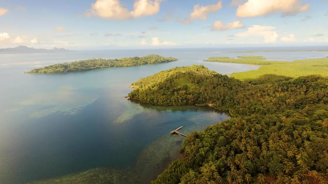
- Panguil Bay shoreline, southern Misamis Occidental, western Northern Mindanao
- Region:
- Northern Mindanao (Region X), component city of Misamis Occidental
- Mayor:
- Sam Norman G. Fuentes
- Highlights:
- Cotta Fort, Panguil Bay access, port trade, seafood, and the new bridge connection toward Lanao del Norte
- Main landmark:
- Cotta Fort and its shrine on the Ozamiz shoreline
- Regional role:
- Misamis Occidental service city linking western Northern Mindanao with Zamboanga Peninsula routes
- Cotta Fort
- Ozamiz port area
- Panguil Bay
Local context
Ozamiz's current mayor reference on this page is Sam Norman G. Fuentes. 2025 local official listings identify Atty. Sam Norman G. Fuentes as Ozamiz City mayor for the 2025-2028 term.
Ozamiz is linked to local place pages including Cotta Fort, Ozamiz Port Area. Those pages help separate the city guide from a generic location summary by giving readers concrete markets, parks, transport corridors, civic districts, and visitor routes to compare.
The city profile emphasizes Cotta Fort, Ozamiz port area, Panguil Bay. These points give the page a practical local frame instead of treating the city as only a name on a regional map.
Landmarks and orientation points
- Cotta Fort
- Ozamiz port area
- Panguil Bay
Frequently Asked Questions About Ozamiz City
What is Ozamiz City known for?
Ozamiz highlights include Cotta Fort, its Panguil Bay port, seafood trade, Misamis Occidental services, and improved road connectivity through the Panguil Bay Bridge corridor.
Is the Panguil Bay Bridge open?
The bridge has changed travel planning around Panguil Bay, but visitors should check current traffic rules, toll policy, and vehicle restrictions before using it.
How do you get from Cagayan de Oro to Ozamiz?
Travelers commonly use buses or vans from Cagayan de Oro through Iligan and the Panguil Bay corridor. Travel time depends on traffic, weather, stops, and whether the route uses the bridge or ferry connections.
Can visitors enter Cotta Fort?
Cotta Fort is one of the main public heritage stops in Ozamiz. Access rules and museum hours can change, so visitors should check local tourism or city notices before going.
Does the Mukas ferry still matter?
The ferry route remains part of local memory and may still serve some movements depending on operator and traffic conditions. The bridge has shifted most visitor attention toward faster road access.
How did the Panguil Bay Bridge change travel to Ozamiz?
The Panguil Bay Bridge changed how people read Ozamiz on the map. For years, travel around this part of Northern Mindanao meant planning around ferry queues, bay crossings, and longer road loops. The bridge makes Ozamiz more visible as a land linked city in the Iligan, Tangub, Tubod, and Misamis Occidental corridor. The effect is bigger than sightseeing because students, traders, families, government workers, fish dealers, and cargo operators all depend on reliable bay movement. Visitors should still check current traffic rules and toll guidance before the trip, because infrastructure openings often come with changing operating policies in the first years.
Why is Cotta Fort important to Ozamiz?
Cotta Fort is the clearest heritage landmark in Ozamiz. It sits near the shore, linking Spanish era coastal defense, Catholic devotion, bay traffic, and the older urban core. The fort and shrine are compact enough for a short visit but meaningful enough to explain why Ozamiz developed as a guarded port settlement on Panguil Bay. The surrounding coast is a working edge of the city, with port movement, roads, shops, church visits, and public errands nearby, which is what ties old Misamis history to the daily movements that still define the bay.
What is the role of Ozamiz as a trade and seafood city?
Ozamiz works as a market and services city for Misamis Occidental and nearby routes. The public market, port activity, transport terminals, schools, hospitals, and government offices pull people into the city from smaller towns, and seafood, dried fish, and bay trade are part of that ordinary economy. The city sits between larger regional forces: Cagayan de Oro and Iligan dominate Northern Mindanao’s eastern side, while Zamboanga Peninsula routes pull west. Ozamiz matters because it keeps the western side of Region X connected to both directions, and the bridge strengthens a market identity that existed long before the new road link.
Source note
2025 local official listings identify Atty. Sam Norman G. Fuentes as Ozamiz City mayor for the 2025-2028 term.