SOCCSKSARGEN / General Santos / General Santos
Sarangani Bay access
Best for
- Bay route
- General Santos
Map address
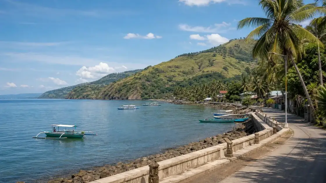
Sarangani Bay Waterfront, Barangay Calumpang, General Santos City, South Cotabato 9500, SOCCSKSARGEN
Why it matters
Sarangani Bay is a 215,950 hectare protected seascape beside General Santos and Sarangani Province, carrying tuna industry, coral, seagrass, marine wildlife, dive, cleanup, and coastal governance stories. The bay features extensive coral reefs, diverse seagrass species, and frequent sightings of marine mammals like whales, dolphins, and dugongs.
Place guide
What to see and do in Sarangani Bay
Sarangani Bay is most accessible from General Santos City, specifically from the waterfront areas near Tambler and the Fish Port Complex, and from coastal municipalities in Sarangani Province including Glan, Maasim, Maitum, and Alabel. The bay is both an industrial fishing zone and a protected seascape, meaning fishing vessels, tuna carrier ships, and recreational boats share the same water.
Diving and Snorkeling
Dive operators in General Santos and in Glan offer reef dives in Sarangani Bay. The bay has 411 documented reef fish species across 2,293 hectares of coral resources and 60 live hard coral genera. This is one of the more diverse reef systems in Mindanao. Entry points and conditions vary significantly by barangay and season.
Marine Wildlife
DENR records confirm whale, dolphin, green turtle, and hawksbill turtle sightings in Sarangani Bay and at its Celebes Sea entrance. Dolphin watching is informally available from fishing communities in southern Sarangani Province. This is not a commercially organized activity the way it is in some Visayas destinations; expect a more grassroots experience.
Best Time to Visit
March through June offers the calmest conditions and best visibility for snorkeling and diving. The Sarangani Bay Protected Seascape Week (SBPS Week) is an annual cleanup and awareness event involving coastal barangays, businesses, and tourism establishments across both GenSan and Sarangani Province.
Local context
Local details to know
BusinessMirror reported that Sarangani Bay was declared a protected seascape under Proclamation 756 in 1996. DENR related coastal environment material and later reporting describe Sarangani Bay Protected Seascape as covering 215,950 hectares.
DENR coastal material places the bay north of its entrance between Tampuan Point in Maasim and Sumbang Point in Glan, with about 240 kilometers of coastline from Pinol in Maitum to Tinaca Point in Glan. BusinessMirror reported that the first SBPS Week included simultaneous bay wide cleanups involving 68 coastal barangays, businesses, and tourism establishments.
BusinessMirror cited DENR figures of 2,293 hectares of coral resources, 60 important live hard coral genera, 411 reef species, and 11 seagrass species in the protected seascape. DENR material records whale, dolphin, green turtle, and hawksbill turtle sightings or reports in Sarangani Bay and its Celebes Sea entrance.