SOCCSKSARGEN / General Santos / General Santos
Kalaja Karsts
Best for
- Geology and upland route
- General Santos
Map address
Kalaja (K'laja) Karst Area, Barangay Conel, General Santos City, South Cotabato 9500, SOCCSKSARGEN
Why it matters
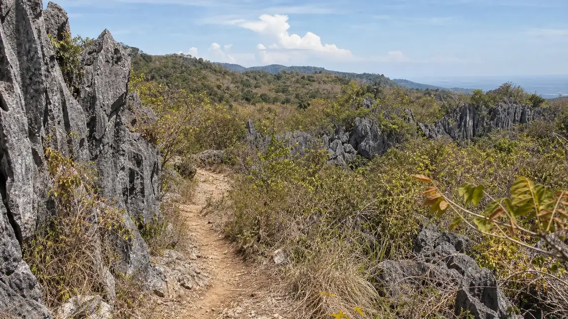
Kalaja Karsts is the inland counterpoint to GenSan's tuna and bay identity, offering limestone formations, cave and trail routes, forest cover, streams, and upland barangay access. Guide coordination, trail condition, water levels, waste, cave safety, and watershed protection are practical concerns ahead of any adventure framing. Trails, weather, and water levels can change, so visits are better treated as locally coordinated trips than casual drive up sightseeing. Caves, streams, and limestone formations are easily damaged by trash, vandalism, or careless movement.
Place guide
Access is the main thing to sort out first
Getting to Kalaja Karsts from the GenSan city center takes a combination of road travel and hiking that most first time visitors underestimate. The route passes through upland barangays where road conditions depend heavily on recent rainfall, and the last stretch before the formations is the kind of terrain that asks you to wear something you don't mind getting dirty. A local guide is genuinely necessary because the area is not signposted in any way that helps outsiders navigate independently.
Best Time and Ground Conditions
The best season to go is between December and March, when GenSan's dry season reduces the likelihood of slippery trails and sudden stream rises. During the wet months, cave access in particular can be restricted because some of the passages fill with water. The cave interiors are dark and cool, and the limestone surfaces are slick even in dry conditions. Headlamps, proper footwear, and slow movement matter more than any other preparation.
Before You Go
What Kalaja offers that you can't get anywhere else near GenSan is a sense of the city's inland geography, which is nothing like the port and commercial identity that most people associate with the place. Standing inside a limestone formation an hour outside a city famous for tuna catches is a genuinely disorienting experience. The contrast with the coast is worth the logistics.
Local context
Local details to know
The area belongs to GenSan's inland barangay routes, where watershed care, trail guidance, and road condition matter. Water levels and trail access can change quickly after rain, so visits are better planned with local guidance than treated as casual drive up sightseeing.